
The coast of southern Mexico was rattled by a powerful earthquake on Tuesday morning that triggered a tsunami alert for Pacific coastlines along Central America.
The United States Geological Survey (USGS) said the quake had a preliminary magnitude of 7.4 and struck around 11:29 a.m. ET, 7 miles west of Santa María Zapotitlán, Mexico.
The temblor had a depth of about 20 miles and was centered along the Pacific coast of Oaxaca state.near the resort of Huatulco.
The quake was felt in Guatemala and throughout south and central Mexico.
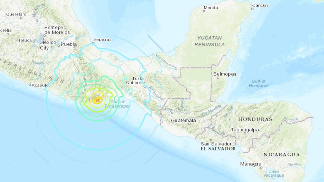
A magnitude 7.4 earthquake in southern Mexico triggered a tsunami warning for the Pacific Coasts of countries in Central America. (USGS)
The National Weather Service's (NWS) Pacific Tsunami Warning Center (PTWC) said that "hazardous" tsunami waves from the quake are possible within 620 miles of the epicenter, along the Pacific coasts of Mexico, Guatemala, El Salvador, and Honduras.
The PTWC said that those located in threatened coastal areas should stay alert for information, and follow instructions from national and local authorities.
Officials said that while a tsunami threat exists for parts of the Pacific located closer to the epicenter, there is no threat for Hawaii or the U.S. West Coast.
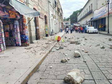
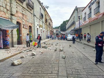
Power was knocked out to some areas in Mexico, but there were no immediate reports of injuries.
Images posted to social media showed damage to some buildings in the Oaxaca state.
The PTWC said that those located in threatened coastal areas should stay alert for information, and follow instructions from national and local authorities.
Officials said that while a tsunami threat exists for parts of the Pacific located closer to the epicenter, there is no threat for Hawaii or the U.S. West Coast.
Power was knocked out to some areas in Mexico, but there were no immediate reports of injuries.
Images posted to social media showed damage to some buildings in the Oaxaca state.
 |  |
The quake along the coast was strong enough to be felt in central and southern Mexico, swaying buildings in Mexico City and sending thousands into the streets.
Seismic alarms sounded midmorning with enough warning for residents to exit buildings, according to the Associated Press.
Helicopters flew over downtown Mexico City and police patrols sounded their sirens.
Mexico's Pacific coast is located along the volatile "Ring of Fire,” a horseshoe-shaped series of fault lines around the ocean.
The region is the location of most of Earth's subduction zones, where oceanic plates slide under the lighter continental plates.
Earthquakes tend to happen when those plates scrape or subside underneath each other, and when that happens at sea it can spawn tsunamis.
This is a developing story. Check back for updates. The Associated Press contributed to this report.


 RSS Feed
